


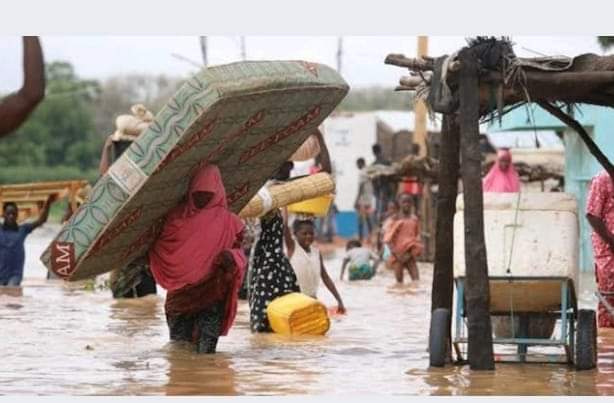
…Floodwaters destroy homes, farmland, critical infrastructure
Niger State has been plunged into a state of emergency as devastating floods have led to the death of 11 individuals and displaced over 41,192 residents across various communities.
The toll comes on the heels of torrential rains that struck on September 21, decimating at least 271 homes and inundating vast tracts of farmland.
In a statement released on Thursday, the Director-General of the Niger State Emergency Management Agency (NSEMA), Abdullahi Arah, detailed the disaster’s impact, noting that 6,865 households have been displaced in 34 affected communities, prompting their relocation to internally displaced persons (IDP) camps.
“The flood incidents have had catastrophic effects, especially in the Mokwa, Shiroro, and Munya local government areas, where the majority of the fatalities were recorded,” Arah stated.
Five of the deceased hailed from Mokwa LGA, with two each from Shiroro and Munya, and one each from Katcha and Rijau LGAs.
The calamity has extended beyond residential destruction, with 246 educational facilities reported as washed away, exacerbating the plight of students and teachers alike.
“We are currently facing significant accommodation challenges for schools, as the floodwaters have left many without a place to learn,” Arah added.
The floods have also wrought havoc on the agricultural sector, affecting an estimated 118,692 hectares of farmland. “Some of these lands had crops ready for harvest, and over 1,600 fish ponds have also been washed away,” highlighted Arah, warning of imminent food shortages.
In response to the escalating crisis, the Niger State government has approved the immediate procurement of food and non-food items.
“NSEMA is actively reaching out to stakeholders, donor institutions, and international partners for necessary interventions to support the affected persons,” Arah confirmed.
The affected local government areas span Mokwa, Katcha, Lavun, Lapai, Agaie, Shiroro, Munya, Gbako, and Kontagora, with additional impact felt in Bosso, Edati, Agwara, Magama, Bida, Mashegu, Borgu, Gurara, Suleja, and Rijau.